NASA's Global Differential GPS system, developed at the Jet Propulsion Laboratory, will be playing an instrumental role in the creation of the Next Generation GPS Operational Control Segment (OCX).
GPS OCX is a Raytheon-led project that is funded by the Air Force with the key goal of improving GPS accuracy for all users. JPL’s expertise in GPS positioning, navigation, and timing will help the project develop a reliable and accurate GPS architecture similar to the NASA Global Differential GPS (GDGPS) system, which provides decimeter (10 centimeters) positioning accuracy and sub-nanosecond time transfer accuracy anywhere in the world.
The Global Differential GPS System
The GPS system is comprised of three segments (or parts):
- Space Segment – a satellite constellation broadcasting a special navigation signal
- Control Segment – ground antennae and data processing for generating the GPS broadcast navigation message
- User Segment – civilians and military
Since its inception in 1973, strides have been made to increase the accuracy of the GPS system. Today, both military and civilians commonly use GPS enabled products for a range of applications that includes everything from guided munition, to natural hazard monitoring, to street navigation devices. Despite a gradual improvement in the performance of operational GPS, both civil and military users have an ever-increasing demand for the highest possible accuracy and reliability.
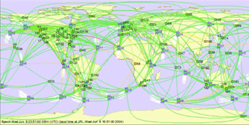
The JPL Global Differential GPS (GDGPS) System was designed to improve upon the positioning and timing accuracy provided by operational GPS. It provides real-time corrections to the GPS broadcast navigation message, which enable certain users to obtain 10-centimeter accurate positions globally. GDGPS employs nearly 100 GPS tracking station that receive the GPS navigation signal and transmit it in real-time to the GDGPS Operation Centers. There, JPL's Real-Time GIPSY (RTG) software package is used to estimate the precise orbits and clock states of the GPS satellites. These estimates are then differenced with GPS broadcast navigation message to create global differential corrections that are much more accurate than GPS information alone. This process with GDGPS takes place in just a few seconds.
Using GDGPS
The GDGPS System is supported and funded by its many civilian and military users who benefit from its high accuracy correction message, as well as other real-time GPS data and positioning services it provides. Some examples of GDGPS services include:
- GREAT ALERT – a natural hazard alert system, which was recently successful in predicting the size of the tsunami triggered by a magnitude 8.8 earthquake off the coast of Chile in February 2010.
- Assisted-GPS (A-GPS) data – provides data and information about the GPS orbit and clock states that allow cellular phones to pinpoint their location on phone map applications and when making emergency 911 calls
- Real-Time positioning – with the user module of the RTG software, users can determine their precise location and time whether they are in space, in the air, or on the ground.
The GDGPS System supports a very high level of reliability for its products and services by employing an architecture based on a high level of redundancy for its tracking network and operation centers.
Evolution Through OCX
In early 2010, the U.S. Air Force selected Raytheon to lead the development of the Next Generation Operational Control Segment. In the $866 million contract, Raytheon, the ITT Corporation, and JPL will port the GDGPS technology to OCX, and tailor it to the needs of the Air Force.
In this project, GDGPS will serve as prototype and live testbed throughout the development, integration, and test phases of OCX, reducing the development risks to the Air Force.
JPL OCX Project Manager, Dr. Yoaz Bar-Sever says that "We will further enhance the maturity and accuracy of the GDGPS software for OCX, benefiting both OCX and GDGPS." In addition to software, JPL will provide its navigation and system engineering expertise to the ITT Corporation (the project’s navigation lead) in developing and implementing the next generation operational GPS, and complying with the government’s demanding requirements for this key national security assets and critical global infrastructure.
Contacts
Yoaz Bar-Sever
Phone: 818.354.2665
E-Mail: Yoaz.E.Bar-Sever@jpl.nasa.gov